Cadastral restitution assisted by artificial intelligence.
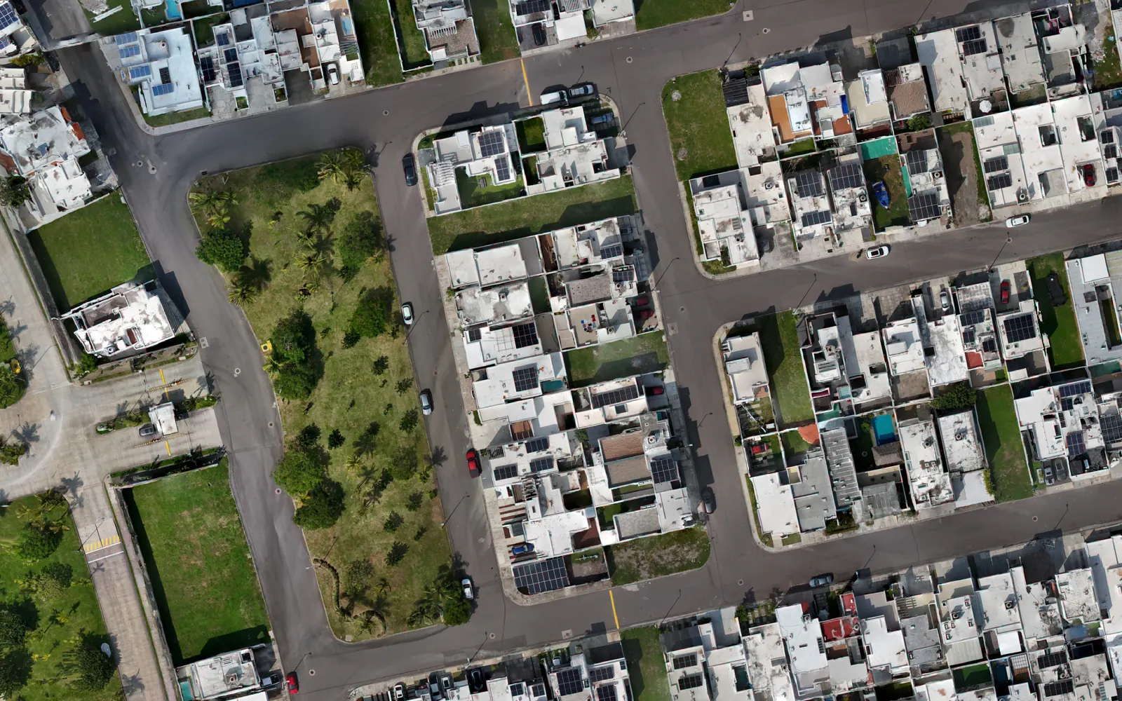
TERRUM Vision flies, models and restitutes every building in the municipality: footprint, floors and built area per parcel, on high-definition true orthophotos. AI proposes; specialists validate.
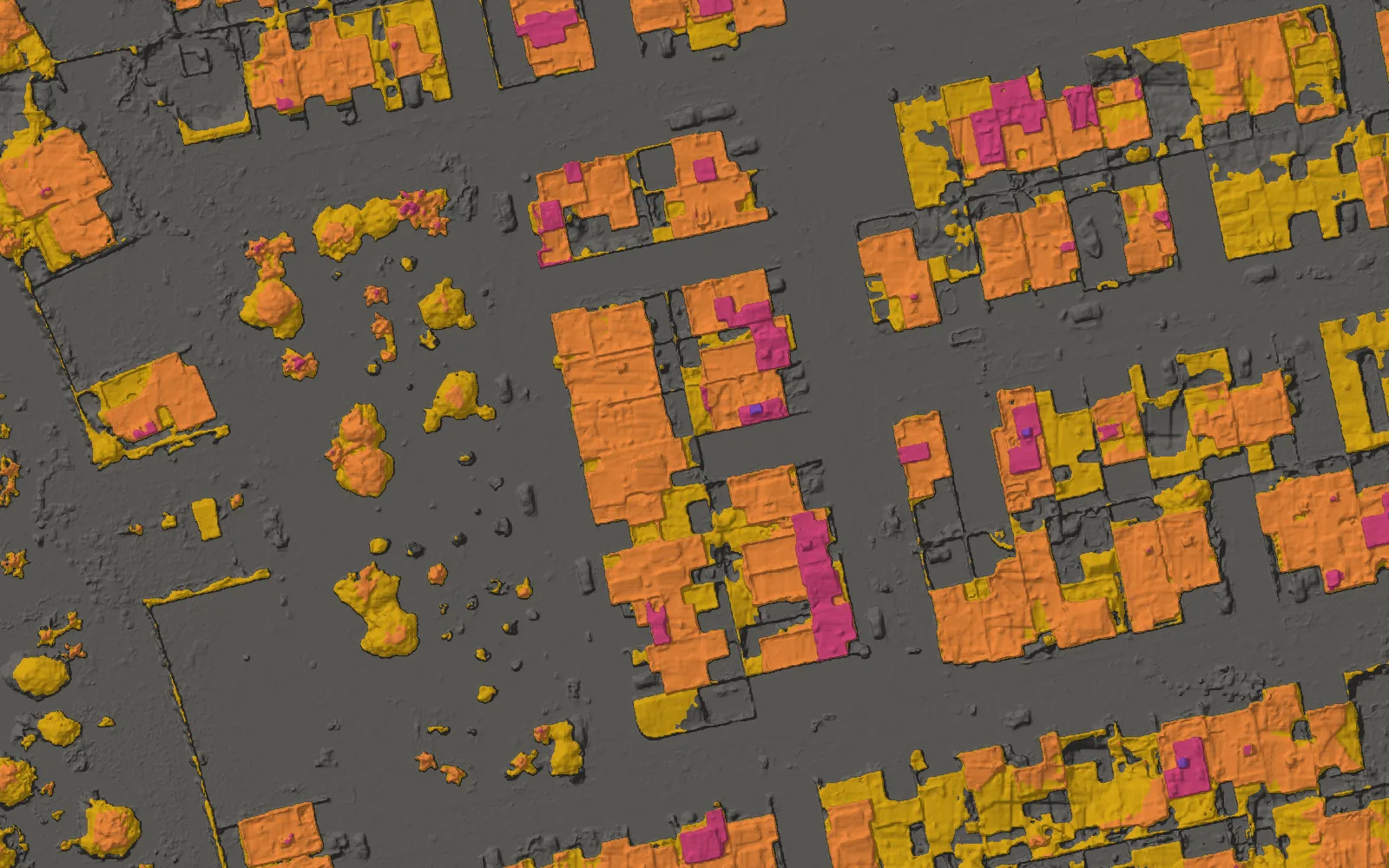
- AI proposal 91
- Validated · 1 floor 10
- Validated · 2 floors 10
- Validated · 3 floors 3
The property registry falls behind the city.
Cities build every day; the cadastre is updated every few years. What is not in the registry is neither taxed nor planned for.
What TERRUM solves
It keeps the registry up to date with the city: it detects where things changed, measures every building with artificial intelligence, and a specialist validates it, without surveying the municipality parcel by parcel.
- Outdated registry
- Problem:Extensions, second floors and new buildings that appear neither in the registry nor in property tax collection.
- With TERRUM:Detects new buildings, extensions and additional floors, parcel by parcel.
- Slow manual restitution
- Problem:Hand-drawing each building on low-definition imagery can take months and delays the update.
- With TERRUM:AI proposes most of the restitution; the specialist reviews instead of drawing.
- Field verification
- Problem:Confirming floors and facades means walking the streets parcel by parcel, with data-entry errors.
- With TERRUM:Floors are measured from the height model, from the desk.
- High operating cost
- Problem:Field crews, payroll and waiting times that grow with the size of the municipality.
- With TERRUM:The change diagnosis directs the work to the areas of greatest impact.
First, find out where the city changed.
Before flying in detail, TERRUM compares the history of the municipality’s orthophotos with its current state and flags the areas of high urban change: where the most was built and where updating the registry will have the greatest impact. Without previous orthophotos, the diagnosis uses recent imagery of the whole city.
- Built-up area today
- Very high change
- High change
- Moderate change
What the diagnosis flags
- New buildings and extensions
- Parcels missing from the registry
- Growth at the edge of the urban area
- Irregular buildings and settlements
The result is a priority map: where to fly first and where the uncollected revenue is today.
Every deliverable, a layer you can review.
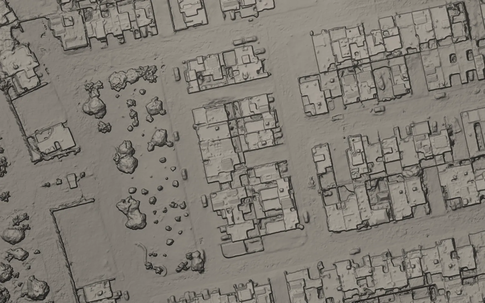
True orthophoto, relief, heights, footprints by number of floors and swimming pools: all on the same base, the way the specialist reviews it in TERRUM Studio. No field visit needed: the color tells how many floors each building has.
What you can’t see, you can’t restitute.
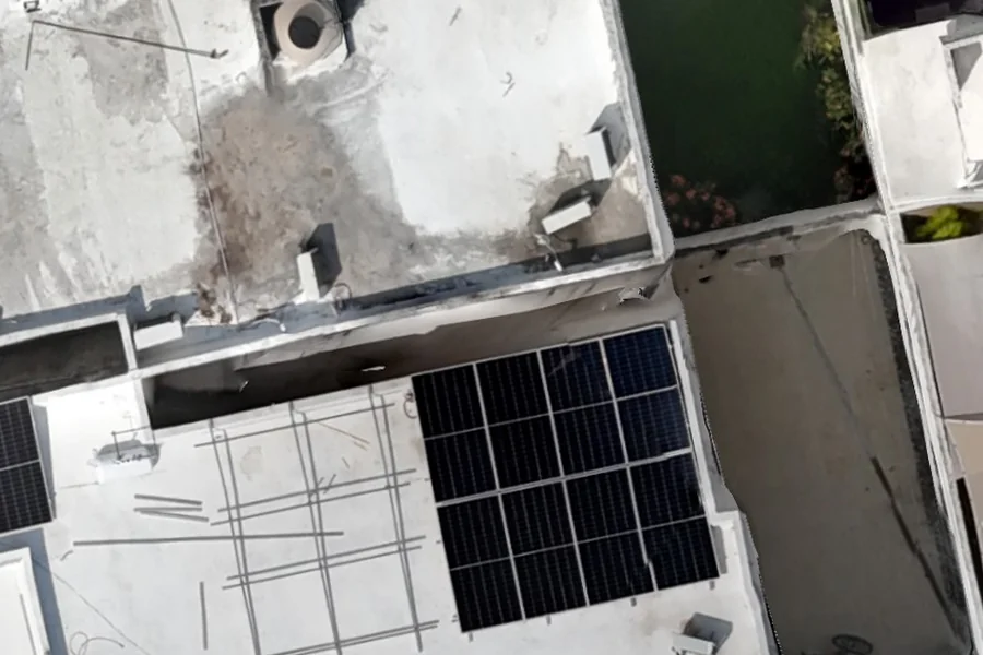
Much restitution work is done on imagery at 10 to 20 cm per pixel. At that scale, walls, eaves, water tanks and slab edges are lost. TERRUM delivers centimeter-level resolution: the difference between guessing an outline and measuring it.

More than revenue: a municipality that knows itself.
An up-to-date property tax is the most visible benefit, but not the only one. A current cadastre brings order to the city and supports decisions across every area of the city government.
Fairer revenue
Those who built or extended pay what they owe; those who haven’t changed don’t overpay. Collection rests on measured evidence, not estimates.
- Urban planning with current data
- Water, drainage, roads and services are planned where the city is actually growing, not where it grew years ago.
- Risk prevention
- Irregular buildings or buildings in risk areas, such as riverbeds and slopes, are detected in time for civil protection to act.
- Continuity between administrations
- Information stays documented and traceable: the next administration inherits a verifiable cadastre, not a pending task.
- One map for the whole city government
- Cadastre, public works, urban development and civil protection work on the same information.
From change diagnosis to an updated registry.
- 01
Diagnosis
High-change areas and order of priority.
- 02
Aerial capture
Full coverage and precise georeferencing.
- 03
Modeling
Terrain, 3D buildings and true orthophoto.
- 04
AI restitution
Footprints, floors and built area per parcel.
- 05
Validation
Specialists review and consolidate every block.
Who backs us
Geoingeniería Aplicada S.A. de C.V.
A Mexican firm specializing in geoengineering and geographic information systems. Its team of experts in cadastre, urban development, mining, digital satellite image processing, digital photogrammetry and cartography has delivered solutions for private institutions and for all three levels of government.
TERRUM was born inside Geoingeniería Aplicada to serve its own cadastral clients, who are already waiting to use it. It is not a product looking for a market: there is demand waiting for it.
About Geoingeniería AplicadaWhere TERRUM stands today
A working end-to-end MVP: diagnosis, modeling, AI restitution and validation.
In development
AI classification of roof and facade materials, such as concrete slab, metal sheet or tile, to enrich cadastral valuation.
Next stage: the platform on the AWS cloud.
- Training and running the AI models, including material classification.
- Scalable processing, from a neighborhood to the entire municipality.
- Remote access so restitution teams can collaborate from anywhere.
- Each municipality’s information isolated and every decision logged.
Frequently asked questions
What is cadastral restitution?
It is drawing and measuring every building on a parcel over an aerial image: its footprint, its number of floors and its built area. That information is used to update the property registry and the property tax calculation.
What is a true orthophoto and how does it differ from a conventional orthophoto?
In a conventional orthophoto, buildings appear tilted and their roofs are shifted from their real position; the taller the building, the larger the error. A true orthophoto corrects that effect with a surface model, so every roof sits on its real footprint and can be measured.
How does TERRUM detect buildings missing from the registry?
First, the urban change diagnosis flags the areas where the most was built. Then the restitution measures every building and compares it with what is registered. The differences, such as new buildings, extensions or additional floors, are identified per parcel and validated by specialists.
Does artificial intelligence replace cadastre staff?
No. AI proposes most of the restitution and specialists review, correct and validate every block. Staff stop drawing by hand and focus on reviewing and deciding.
How long does it take to update a municipality’s cadastre?
It depends on the area and on the state of the existing maps. The change diagnosis is the first stage and helps define scope and schedule; we estimate it for your municipality in the demo.
What happens to the municipality’s information?
It is processed in isolation from other municipalities’ data and the registry remains under the municipality’s control. Every change is logged: who restituted, who validated and what changed.
How is restitution quality ensured?
The system checks rules automatically, for example when the floors don’t match the measured heights or a building encroaches on the neighboring parcel, and a specialist validates every block before delivery. Each delivery is checked against agreed accuracy tolerances.
Does it work for an entire municipality?
The platform is designed to scale in the cloud from a neighborhood to the whole municipality without multiplying the team. The change diagnosis helps start with the areas of greatest impact.
Update your municipality’s cadastre.
Request a demo and see how we would work with your municipality.
Or write to [email protected]
By writing to us, you agree to the processing of your data under our privacy notice (in Spanish).